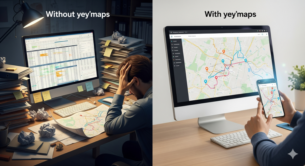
Turn Complex Water Networks into Clear, Actionable Insights
Managing pipelines, pumps, and assets shouldn’t mean searching through scattered spreadsheets and outdated maps. With yey’maps, you bring all your utility data into one intuitive platform — helping your team make faster, more informed decisions.
Key Benefits
Smart Digital Mapping
Digitize pipes, hydrants, valves, meters, and more
Lots of COGO functions
Organize data in layers and user groups
Assign Viewer, Editor, and Admin roles
Streamlined Maintenance
Mobile work orders
Field data capture
Recurring Tasks
Asset work order history
Integrated 311 Reporting
Faster response to leaks/outages
Streamlines the process of responding to citizen reports
Clear communication with residents
Increased public confidence
SCADA & ioT
Monitor and control the entire water network
Proactive Leak and Pressure Management
Detect anomalies early
Log vast amounts of operational data
AI
Query your network using human language
Detects patterns in infrastructure data
Identify at-risk pipes or hydrants
Extend asset life
Automation
Isolate water pipes for repairs
Detect affected households for repairs
Aoto-create mainenance schedules
Optimizes meter inspections
What you can do with yey'maps Water Utilities
Small towns and utility companies, in particular, face unique challenges: limited staff, tight budgets, and many responsibilities at once.
Map and visualize your entire network in one place.
Monitor maintenance schedules and inspection reports.
Create custom reports for compliance reporting.
Access data in the field with mobile-friendly apps.
Share maps securely with contractors, regulators, and stakeholders.
“yey'maps' mapping program has been a great asset within our company and for our clients.
Any time we need assistance, their staff is quick to respond and will resolve any issues efficiently. Highly recommend.”
“yey'maps is an easy and affordable way to design and generate online maps.
It's been very useful for my clients so far.”
“With yey’maps, we digitized our entire water network in less than a month. Now our field crew can access maps directly on-site — saving hours every week.”